Worldwide, many cities are facing water crisis. A number of factors, which are responsible for this crisis include growing urbanization, inadequate rainfall, lack of awareness about water conservation, recycling and reuse of water, etc. Hence, effective water resources management is a need of the hour. The present paper describes the feasibility study carried out for a captive water supply scheme for one township near Neral town in Thane district of Maharashtra. Rainfall data and contours were studied and hydrogeological study was carried out to understand the quantum of water availability. A number of measures are suggested for effective water management of the proposed township. These include construction of an artificial reservoir to collect and store the runoff generated from catchment area, use of surface stormwater for ground water recharge, rooftop water collection system for gardening and flushing and use of excess rooftop rainwater for recharging of bore wells. It is proposed to have 20 bore wells and four open wells.
Feasibility study of a captive water supply scheme for a new township
Abstract
Contour and ground slope of the plot
The proposed township is located close to the hilly region, which is a part of Sahyadri mountain ranges. Location of the township is shown on the Google image as shown in Fig. 1. Plot contours and ground slope were studied as shown in Figs 2 and 3 respectively.
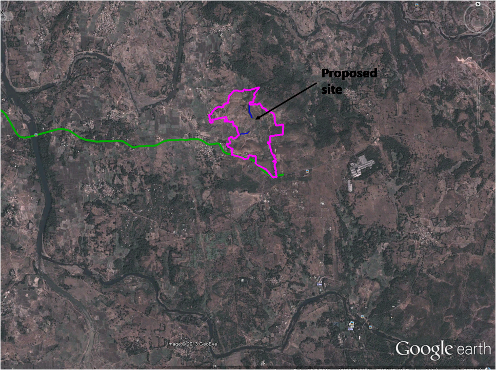
Fig 1. Google image showing the location of the plot.
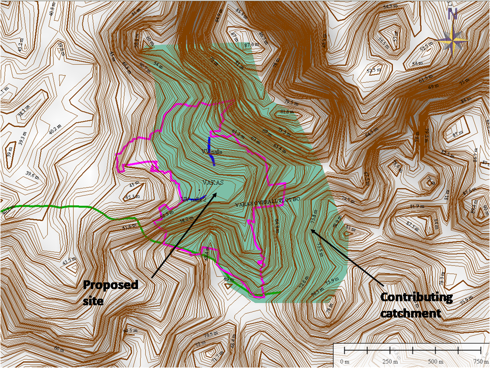
Fig 2. Location of the plot on the contour map.
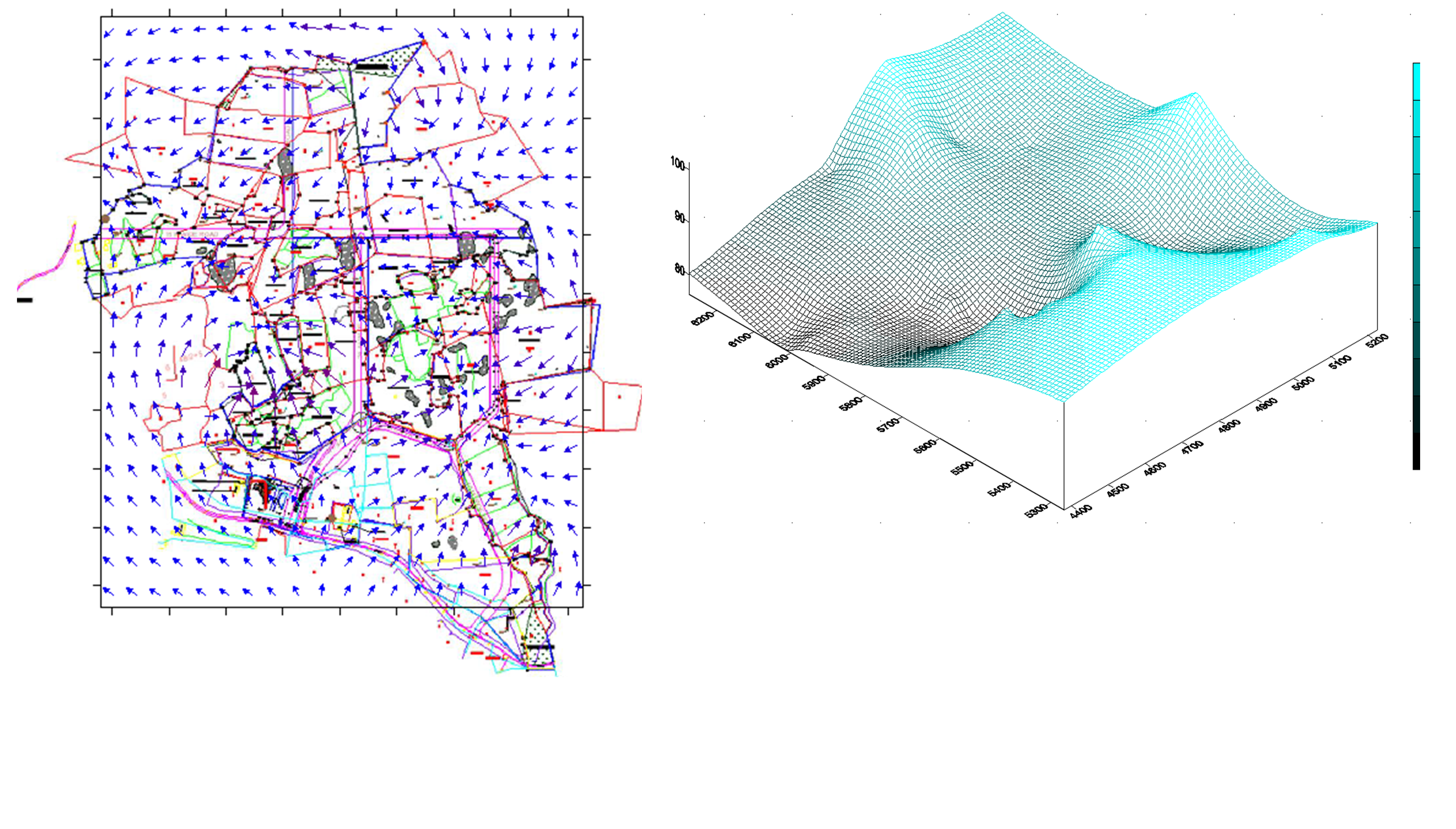
Fig 3. Slope of the Plot.
Soil investigation and hydrogeological study
As a part of geotechnical investigations, twenty-seven boreholes were taken (Fig 4). Ground water level was observed in all boreholes during fieldwork and after completion of the drilling. Bore well investigation was carried out. Water availability at various depths has been shown in Fig 5. Yield of the borewell was also studied and it varies from 200 lit/hour to 4,000 lit/hour
.png)
Fig 4 Locations of the borewell (Levels w.r.t. B.M. of 100.00 m).
.png)
Fig 5 Water availability at various depths (Levels w.r.t. B.M. of 100.00 m)
Electrical Resistivity Tests (ERT) were carried out to identify locations for groundwater developments at the site. The major geological formation in the area is amygdaloidal basalt. Secondary porosity is seen to develop due to fracturing during deposition. The area has thick soil cover. The area is productive as it contains large opening in definite previous horizons, besides being susceptible to weathering. The top most layer consists of soil with thickness of about 4.0 m. The second layer consists of basalt having fractured and jointed weak planes which become aquifers during monsoon only. The rise in resistivity values in the third layer is indicative of the decrease in saturation with increase in depth. In this area, groundwater occurs in the pore space of basalt, under confined, semi-confined conditions. It also occurs in the secondary porosity formed by weathering of basalt. The groundwater is mainly recharged due to precipitation and seepages.
Water demand
The housing project is proposed to be developed in a phased manner. Project tenements and population have been studied and phase-wise water demand has been computed and given in Table 1. Water demand has been computed considering 135 litres per day per person.
Table 1 Phase wise water demand

Water resource management
Various options have been evaluated to meet water demand. The possible sources of water supply have been identified as below:
- Utilization of collected rainwater during monsoon
During monsoon, rooftop water is proposed to be collected in collection tanks, to be used further for gardening and flushing. Excess roof top rainwater is proposed to be used for recharging bore well. Subsequently, surface stormwater is proposed to use for ground water recharge. - Bore wells
It is proposed to have 20 bore wells. Considering the yield of 3000 lit per day per well, 60,000 lit per day water will be available. - Open wells
Four open wells have been proposed and 20,000 lit per day water will be available from them. - Artificial reservoir
The catchment area contributing to the plot is 1.043 km2 (Fig 6). Considering annual average rainfall of 3000 mm, 219.03 million liters of runoff volume will be generated per day. Considering the terrain, 18,900 m2 of area can be available for construction of artificial reservoir (Fig 7). Around 756.0 million liters of water can be stored in a reservoir having an average depth of 4.0 m. Considering evaporation and other losses, it is estimated that 529.2 million liters of water can be available and same can be used during non-monsoon period. Thus, 1.45 million liters of water can be available per day.
Table 1 shows the phase-wise water demand. The total water demand for the project is 3.36 mld (potable water demand = 2.24 mld). The 1.45 million liters of water available per day will meet the potable water demand of 1611 population (322 flats) at the rate of 90 liters per person. Flushing water demand can be fulfilled from the grey wastewater treatment system.
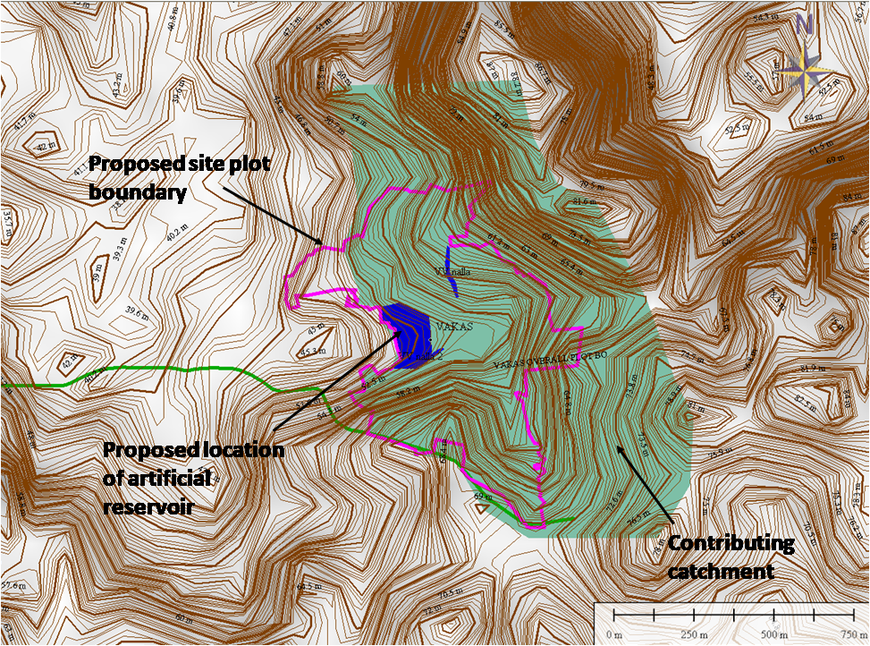
Fig 6 Contributing catchment and location of an artificial reservoir.
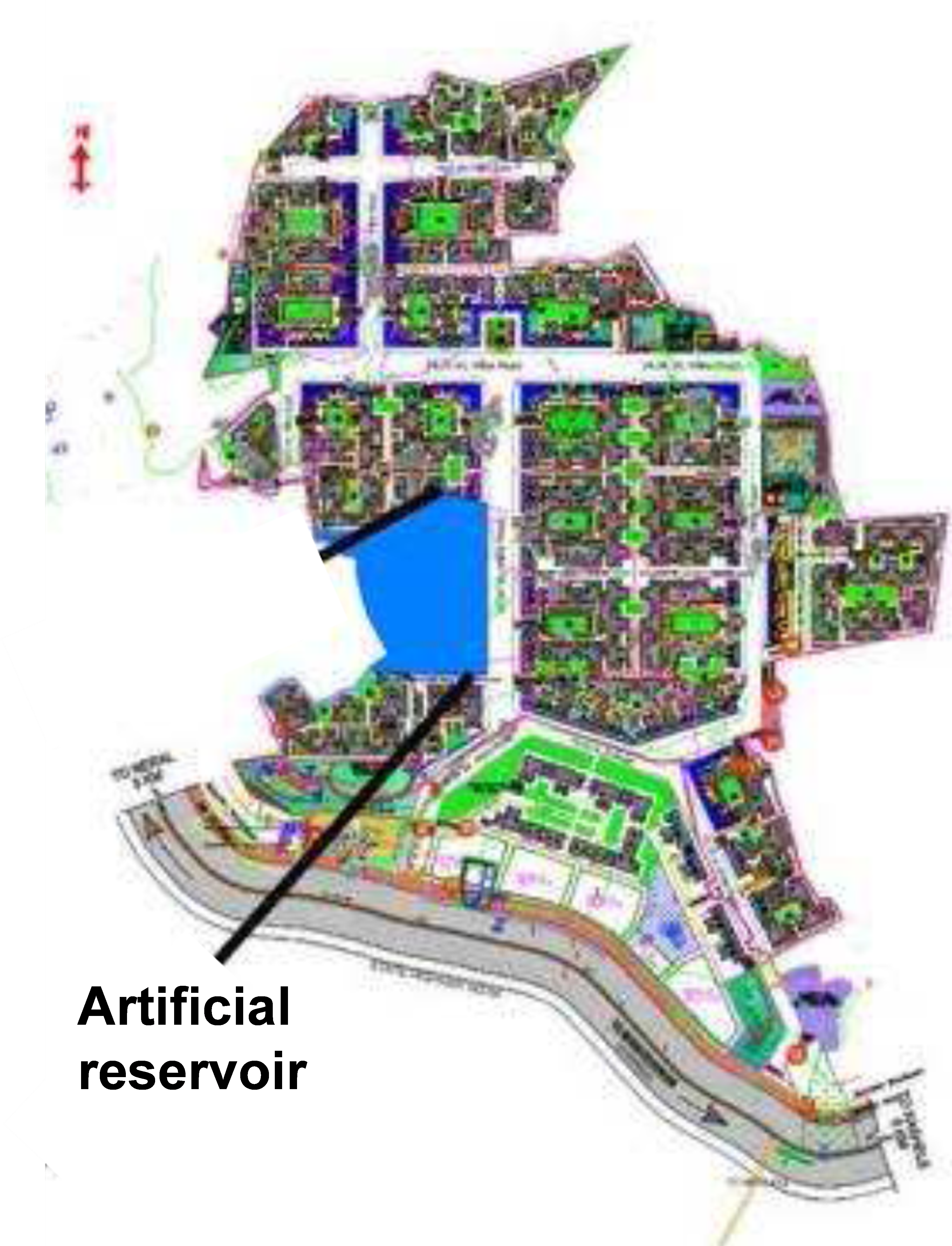
Fig 7 Location of an artificial reservoir.
Conclusion
Before the construction of a new township is taken up in remote area, where municipal water supply is not available, it becomes essential to undertake a detailed study to estimate the water availability from natural sources. It is also essential to suggest measures of water resource management. The case study presented here shows how a captive water supply scheme can be designed for an independent township.

